Streams to the River Maps
Maps and map activities that correlate to the chapters in Scott's O'dells book,
Streams to the River, River to the Sea.
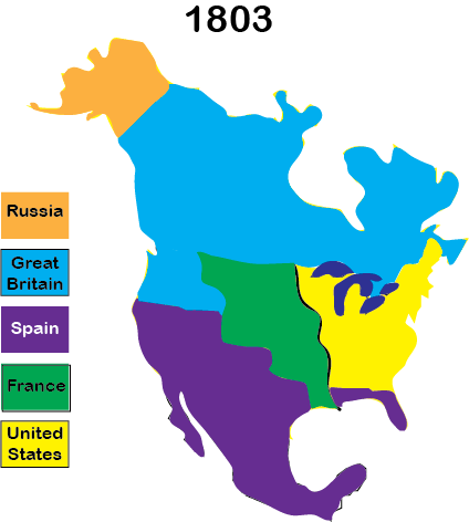
Before the Louisiana Purchase
Geo-Political Map of 1803
Author's Note: Activity at the Beginning of the Book
Before Beginning the Unit Study
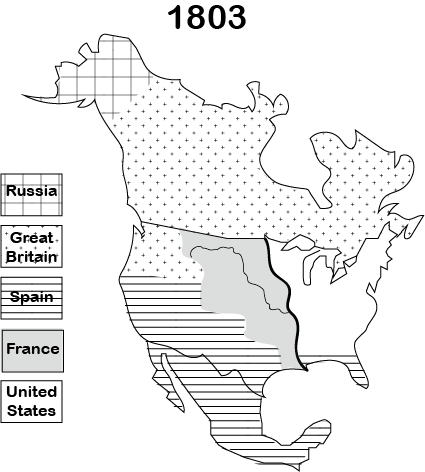
The black and white map above is used for an introductory activity in conjunction with the Author's Note by Scott O'Dell in Streams to the River. Students color the areas of the map a different color as they digest the political situation that led Thomas Jefferson to make the Louisiana Purchase.Chapters 5 and 6
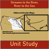
Map of Hidatsa Villages and Fort Mandan
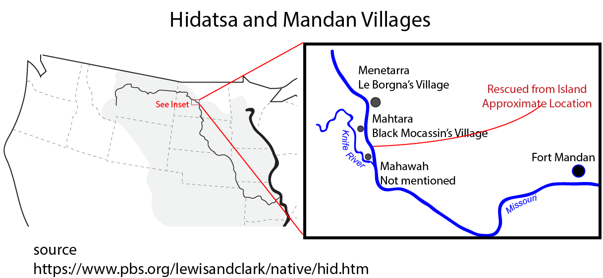
In Chapter 6 she attempts to flee downstream back to the Mahtara village. Her boat continues past the village and gets stuck on a sandbar.
More information about the villages in this area can be seen at the Knife River Indian Villages run by the National Park Service.
Sacagawea's Westward Journey
Lewis and Clark Westward Movement from Missouri to Pacific
Chapter 13 - 24
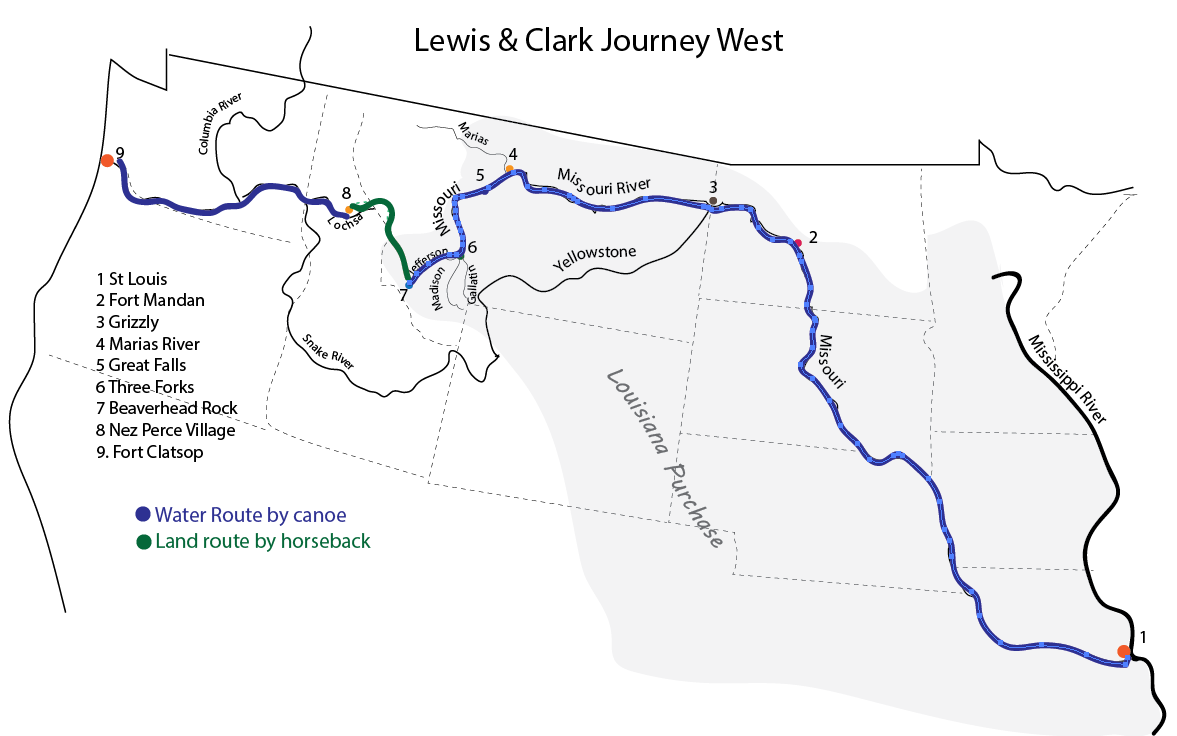
Our unit study map numbers the places mentioned in the book. It also differentiates the important journey by horseback through the mountains (the reason Sacagawea was invited to begin with.)
The unit study also discusses the significance of the change in direction of water flow once they return to the canoe at the Lochsa River.
Sacagawea's Eastward Journey
Lewis and Clark Eastward Movement: The Return
Chapters 26 and 27
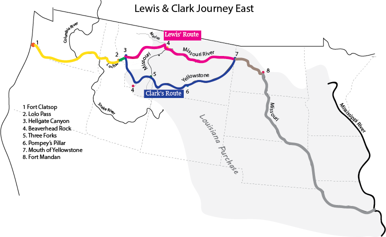
The yellow portion is their trip by canoe. The green shows their first travels across the mountain by foot.
The pink and blue illustrate the travels of the divided party as Lewis continued his (futile) search for a water route that could be used for trade.
The brown line is the route of the reunited party as it makes its way back to Fort Mandan where Sacagawea and her husband Charbonneau remained. The gray route shows the final trip of the expedition as return to their starting point without Sacagawea.
Mississippi and Missouri River
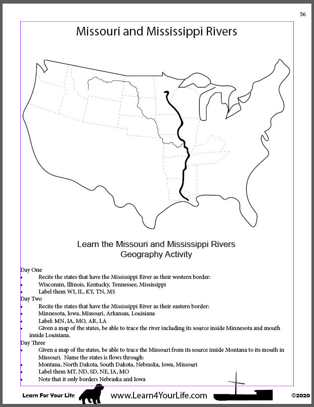
Students have a three-day, simple-to-do activity to become more familiar with the geography of the states through which the Mississippi and Missouri Rivers flow.
Louisiana Purchase vs Missouri River Water Basin
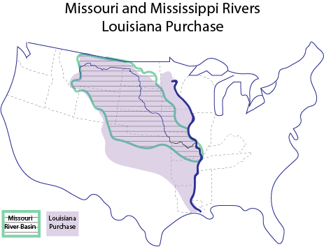
The Mississippi River is its eastern border, just as the Mississippi River was the western border of the United States prior to its purchase.
But it is the Missouri River, not the Mississippi River, that the land is formed around. The map above shows the Lousisiana Purchase in light purple. But the area with the lines is the water basin whose lands send their rain water into the Missouri River.
The Great Divide
Lewis and Clark and the Great Divide
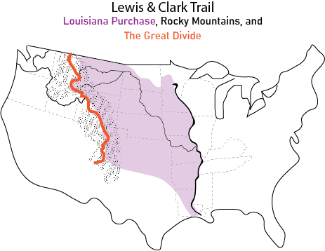
On the west side of the Great Divide, the water flows into the Snake River and Columbia River and then into the Pacific Ocean.
Who cares? No one. Unless you happen to be traveling by canoe. Then the direction of the water is reversed. Then it makes a BIG difference whether you are trying to row upstream or downstream.
So, yeah, pulling the keel boat and canoes upstream against the current made the Continental Divide a signficiant geological feature to the members of the Corp of Discovery.
Buy Streams to the River Unit Study
Literature Study Based on Scott O'Dell's novel about Sacagawea
Student Guide AND Teacher's Answer Key Included
$2.99 Download - 121 pages
![]()
Streams to the River, River to the Sea
Information on the historical fiction novel about Sacagawea by Scott O'Dell
Unit Study
121 page unit study with chapter activities
Maps
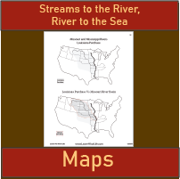
8 different maps of the Lewis & Clark Expedition
Vocabulary
Vocabulary lists for each chapter
Themes
Themes, symbolism, and literary analysis


Ready To Use Resources


About Our Site
Hands-On Learning