Beowulf Maps
Maps of lands, regions, and people in the story of Beowulf.
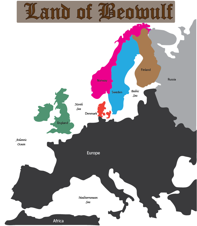
These are some of the maps in Facing the Dragon - The Beowulf Unit Study. See below for more information.
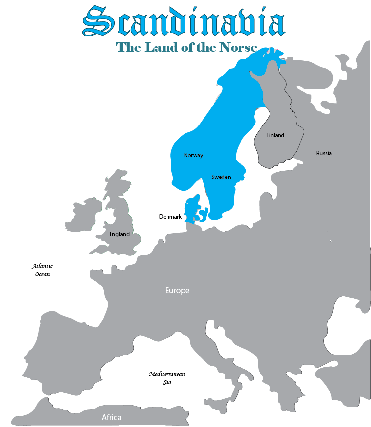
The Norsemen
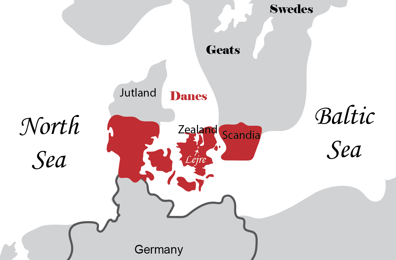
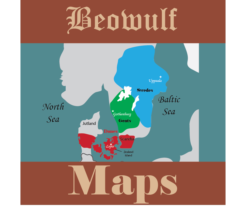
Tribes and People in Beowulf
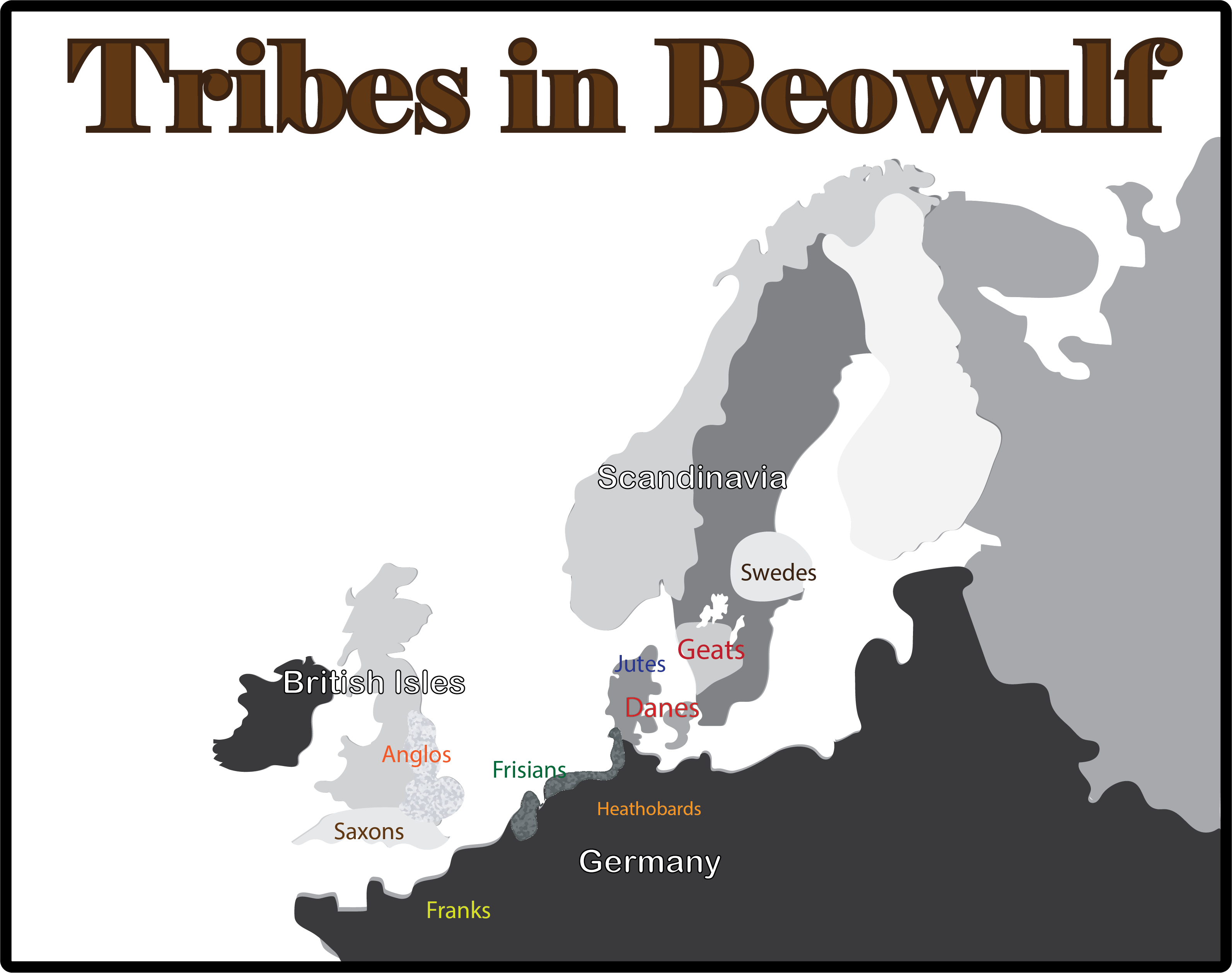
It was a clash of cultures - a struggle to dominate or perhaps to just survive.
The map above shows the approximate location of tribes mentioned in the poem. (Remember, tribes are often mobile so putting a dot on the map is not entirely accurate.) Of course, Germany, British Isles, and Scandanavia, which are labeled on the map for modern students, were not designated by such names at that time.
Heorot Hall In Lejre
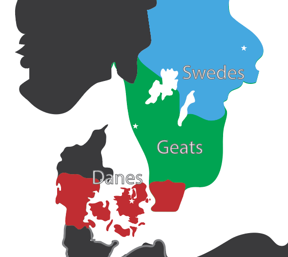
6th Century Territory of the Danes
This map also gives you an idea how the spear-carrying Danes of Beowulf became the sailing Vikings in the centuries that followed. They needed to travel by sea to keep in touch with their own people. Once on the waves, why stop with their own lands?
Seats of Power of the Danes, Geats, and Swedes
Swimming Contest with Breca
The Brondings and the Finns
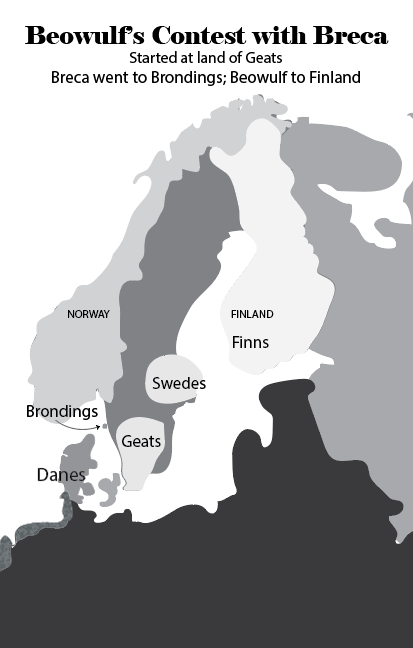
Bronding is considered to be the island of Branno, off the western coast of Sweden, and north of the Geat territory, as shown in the map above. Others have placed the Brondings in south Norway, which as you can see on the map above is still further north.
Beowulf, on the other hand, swam to the land of the Finns.
Now since this contest started in the land of the Geats, which is on the west side of Swedish peninsula, one can readily see from the map that Beowulf had a far longer swim.
He makes swimming the English Channel look like kid stuff.
And that is exactly the point. It is super-human for the two youths to attempt to swim in the cold ocean for seven days, bedecked in an iron suit-of-war, and carrying a heavy sword. Then Beowulf got dragged to the bottom of the ocean and killed nine sea-monsters. Before swimming to Finland.
Yeah, right! This was the original Marvel Comics!
A Map of Dragons
Long before I ever heard of Beowulf, I thought the northern peninsulas looked like a two-headed or three-headed dragon reaching down to bite Denmark.An optional activity in the unit study is to let students find monsters and dragons in the map. It's a Rorschach test just for Beowulf fans!
Here's my monster-finding map:
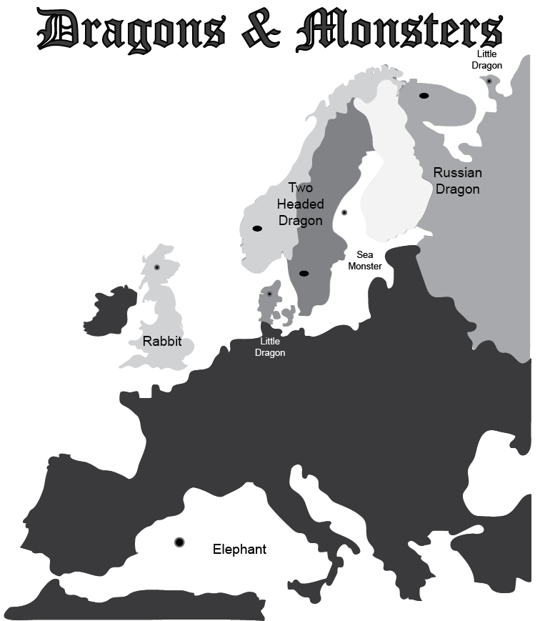
Beowulf's dragon and sea-monsters can be imagined from the European map.
Location of Beowulf's Burial
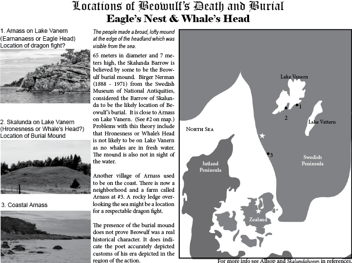
Unit Study Page on possible Beowulf Burial Mound
In our unit study we look at some of the places in Sweden on Lake Vanern (Lake Weder in the poem) that may be the locale the author had in mind. He gave enough specific names and details that our Beowulf-Hunters actually have a pretty good chance of getting this right!
More details (as well as speculation!) can be found on our page on the location of Beowulf's death and memorial.
Get the Beowulf Unit Study
Unlock the action plot, history, and debates of the ancient tale.
Available in Paperback OR Printable Download
253 pages
(Includes Student Pages, Teacher Key, References, Maps, Charts and More!)
Print It Now

![]()
$5.99 Your link to print will last for five days.
Ready-in-a-minute lesson plans can be used with any translation.
Easy-to-read summary for each section.
Softcover Edition - Mailed to You
The same pages are in the softcover book and the printable file. Keep your papers bound together and use this book for years to come. It will be your go-to-guide for all things Beowulf!

![]()
17.95 Soft Cover Manual
Mailed to You
Beowulf Pages
Check here for all things Beowulf.
Facing the Dragon

Middle & High School
Lesson Plans
Content by Section
Maps
The Land of Beowulf
Themes
Theme/Motifs/Purpose
The Finn Tragedy
Finn, Hildeburg, Hengst
Mirrored Reflection
Mise en Abyme
Modern Summary
Section by Section
Beowulf's Monsters
What is their role?
Why Read It?
4 Benefits of Beowulf
7 Challenges
The Gulf Between Us
Best Quotes
From & About the Poem
Basic Info
Who? When? Where?
Timeline
Dates of Events
Manuscript
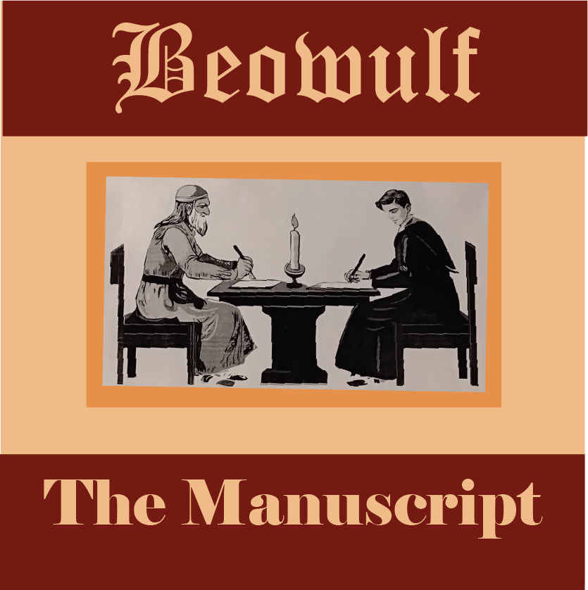
How We Got It
Funeral Site
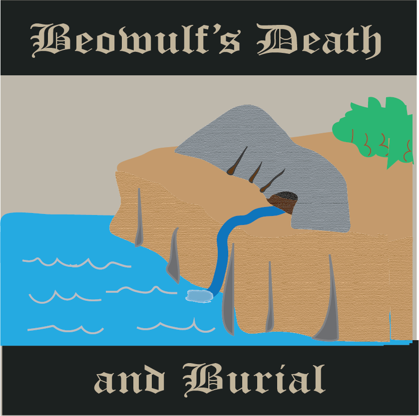
Has It Been Found?
Ready To Use Resources


About Our Site
Hands-On Learning